Cyclone Murasu hits Andhra Pradesh: Vijayawada roads flooded as storm brings heavy rain and 120 kmph winds
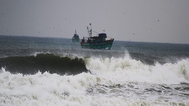
Vijayawada woke up to flooded roads and disrupted traffic on Tuesday as Cyclone Murasu brought intense rainfall to several parts of Andhra Pradesh. The downpour, which began late Monday night and continued into the early hours, left stretches of the city struggling to cope with accumulated rainwater.
Among the affected stretches were Bandar Road and Polyclinic Road, along with parts of One Town. Waterlogging made commuting difficult as the city experienced the impact of the severe cyclonic storm moving in from the Bay of Bengal.
The storm has since crossed the south Andhra Pradesh coast, but the threat of heavy rain and strong winds remains a concern for the region.
Cyclone Murasu landfall: Where did the storm cross the Andhra coast?
The India Meteorological Department (IMD) had forecast that Murasu would cross the coast between Nellore and Narsapur, close to Ongole in Prakasam district, during the early hours of November 3. According to the IMD bulletin issued at 1.15 am, the landfall process had begun, with the forward part of the cyclone's wall cloud entering the coast and its eye approaching land. The storm brought sustained winds of 100-110 kmph, with gusts reaching 120 kmph.

The Era of Forever Wars
30 Oct 2026 - Vol 05 | Issue 44
Coping with an explosive Middle East
The Economic Times, in its November 3 live coverage, reported that the cyclone had crossed the coastline by around 6.40 am. The system's movement inland is expected to bring changes in the distribution of rainfall, even as weather warnings remain important for affected districts.
IMD warning: Storm surge and heavy rain threaten coastal Andhra
The cyclone's impact extends beyond the immediate landfall zone. Before the storm crossed the coast, the IMD warned that a storm surge of around 1 to 1.5 metres above the astronomical tide could inundate low-lying parts of south coastal Andhra Pradesh.
Bapatla, Krishna and Prakasam districts were among the areas expected to face the highest surge. Such a rise in sea level, combined with heavy rainfall, can increase the risk of flooding in vulnerable coastal settlements.
The weather department also forecast heavy spells of rain across south coastal Andhra Pradesh during the 12 hours following its early-morning bulletin. The Andhra Pradesh State Disaster Management Authority's live cyclone information system continued to carry alerts for heavy rain and strong winds in several districts.
Which areas are under the Cyclone Murasu alert?
The cyclone warning covered parts of south coastal Andhra Pradesh, including Nellore, Prakasam, Bapatla, Guntur and Krishna. District-level alerts also flagged the possibility of intense rainfall and gale-force winds in affected areas.
The state disaster management authority has advised residents to remain alert and follow official instructions. People in low-lying and coastal locations should pay particular attention to local evacuation advisories and avoid venturing into rough seas or flooded stretches.
For Vijayawada, the immediate concern is the impact of continued rainfall on roads and daily movement. While the cyclone has crossed the coast, its passage does not mean the weather threat has ended. Further rain and strong winds could continue to disrupt normal life across parts of Andhra Pradesh.
(With inputs from ANI)